mercoledì 28 dicembre 2011

Pharaoh bathrooms

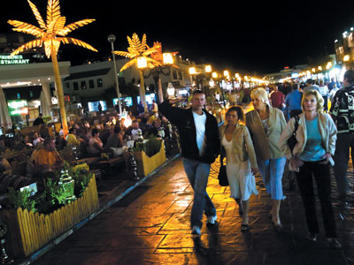
Known to Arab Republic of Egypt it is one of the countries that are characterized by
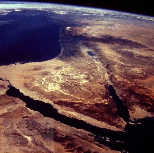
Tourism overall, and bathrooms with Pharaoh, which is located in South Sinai, 250 km
Meters from Cairo tops the list of tourist destinations on the tourist can charm
Beaches to enjoy swimming and physical therapy at the same time, because of its area of
Grant Hlajia divine through the hot sulfur water flowing from the springs inside the mountain
In front of the water of the beach ..

As for the caves inside the mountain Vmnhot higher sulfur springs, for the benefit of emissions
Heat from the top to the bottom of the cave, too small in the region that separates the water from the beach
The mountain, can take advantage of the soft sand in the hot natural treatment ..

And although a few media spotlight hanging over pools of Pharaoh, but the hope is still present
After the news, which confirmed the government would invest a healthy tourist resort area unique in its kind
In conclusion .. Leave you with pictures and wishes that you will enjoy the trip.


صورة

صورة

صورة

صورة

domenica 4 dicembre 2011

Hurghada

Capital of Hurghada, Red Sea .. A modern city .. Now 90 years old, has been established with the discovery of oil wells near them .. It was several years ago a small town is characterized by fishing .. With the development of tourism activities has become the most famous tourist cities in the world

Here are some pictures of them

 صورة

صورة 

Hurghada city limits without a magic mermaid and the Red undisputed
The city of Hurghada, which is the largest tourist resorts in Egypt and the center
Nautical world .. If you want to place under water or above the water vertically.
In Hurghada .. Or skid on the water or sailing in the water or if you want
Exercise
Diving under the water .. Where you will find many wonders ..

Hurghada is considered the first level in the world where the warm waters
Which embraces the rare species of fish and coral reefs, which
You can see through the submarine.

Hurghada and is characterized by soft sand beaches and the color of sand is Tgdonh-dropped
Beaches and other city it very hygienic and quiet and lush
Restaurants open

Giftun Island:
Great place to practice diving, deep sea and watch the boats using the
Submarine or glass bottom. There's also a museum there as well as aquatic
Many of the effects ROMANIAN when smoke near Mt. And there they can exercise
Safari and exploration of the Red Sea mountains.

A trip to South Africa

صورة 

Republic of South Africa:

Is a large country in the far south of the continent of Africa, is the southern tip of the continent, bordered by Namibia, Botswana, Zimbabwe, Mozambique and Swaziland.

Economy is the largest and most developed of all African States, the modern infrastructure found in almost all parts of the country, and covers an area of ​​South Africa 1.331 million km,

The population of the Union in 1988, 33,763,000 people.

 صورة 

And the Union of South Africa's capitals, a city of Cape legislative, administrative, and Pretoria is the capital's population of some 750,000 inhabitants, and the city of Cape more than a million people.

  صورة 

(Cape Town, which is one of the most beautiful cities in South Africa)

In South Africa is also the largest population of European descent in Africa, the largest Indian population outside of Asia, and the largest community of color (black skinned) in Africa, making it one of the most diverse nations in the population on the African continent.

According to statistics conducted in 2008, 79.7% of the population are Christians, 1.5% Muslim, 1.2% Hindu, 0.2% Jewish, 0.3% local religions, while the humanists is 15%.

  صورة 

(One of the most beautiful football stadiums in South Africa, which was held in which some Mbarat World Cup for 2010)

After a quick overview of this country for geographical location and diversity of population, we come to the most important part of this journey, not a normal life in this picturesque country, as well as wildlife.

Many may think that all African countries suffer from drought, poverty and hunger, but the Union of South Africa is a country full of wealth of nature, and nature of the country with witch we see in a lot of television channels

  صورة 

The secret of its appeal lies in the wild, the beauty of his creatures, which is a tourist destination for all the world's population.

  صورة
صورة
صورة 

Now, we will field tour of the prairies to identify the most important and beautiful wild creatures of Africa.

Not pleasant trip without going through the first King of the Jungle (lion), and recognize Him in simple words.

  صورة 

Wild lions currently exist today in the remaining sub-Saharan Africa, are black social animals significantly compared to the rest of the members of the platoon .

  صورة 

There is no more beautiful than the look more closely at the wild creatures on earth, namely, the African elephant.

  صورة 

Okprhjama of the Indian elephant and is characterized by a larger ears that resemble the continent of Africa, and African elephants more aggressive and therefore did not facilitate the training.

In Africa the female lead is not large herds and males and is characterized by elephant and other animals from the rest of the long trunk, which is an extension of the nose and upper lip and does the work of the human arm

Finally we come to her tall, neck transcendent above the trees of Africa, namely Her deadly kick ..
Giraffe

  صورة 

According to a study published in the Journal of genetic <<BMC Biology>> that giraffe species are not one but six varieties, and many giraffe animal movement, which frequently transmitted to a distance of 50-300 km.

The length of the horns Giraffe 5 inches, and though the giraffe's neck long but it contains only seven vertebrae, and these seven Vqrt not help not to drink water after opening the front legs of the giraffe

  صورة 

But this small number of paragraphs helps the giraffe with easy access and fixed to the high trees to eat leaves long tongue, which is 16 inches.

The length of the giraffe 10 yards, and of course this length the great must have a giraffe heart is too large in order to pump blood to the top of the head, and the weight of the heart of the giraffe to 25 lbs or 11 kg, and in the absence of the heart of this size to hit faint whenever lifted her neck to the top.

Sinai

صورة  

صورة  

Egypt is rich in many of the beautiful tourist places, and not for our tour today in place of the most beautiful parts of Egypt is characterized by both traditional beauty and warm .. Sinai ..Is the Sinai Peninsula in the northeastern part of Egypt and take the form of a triangle, and was historically a place for gathering of tourists from around the world and because it is the crossing of civilizations of the ancient world in the Nile Valley and the delta rivers Tigris and Euphrates and the Levant.Sinai and full of many tourist attractions that attract tourists, and most important of these attractions:Sharm El Sheikh:It is a resort located on the Gulf of Aqaba, the resort has seen many important conferences, has received Resort Sharm El Sheikh overlooks the Red Sea in the Cities for Peace Prize in 2000 2001, awarded by the United Nations Educational, Scientific and Cultural Organization "UNESCO". And became a port city on the Gulf of Aqaba, a well-equipped tourist resort in the southern Sinai Peninsula.Ras Mohammed:Located at the confluence of the Gulf of Suez and the Gulf of Aqaba in the southern part of Sinai, about 12 km from Sharm El Sheikh and include examples of the most important geologic features in the Sinai, which was considered the most beautiful diving areas in the world to the existence of fossils are due to 75 000 in addition to the richness in coral reefs and wildlife. has been converted to Ras Mohammed Nature Reserve in 1982.Dahab:Some interpret the name of the name, given to simulate the Bedouin of the sand glittering under the light of the sun in gold, which is located approximately 100 kilometers northwest of Sharm el-Sheikh, which is considered one of the most beautiful parts of the Sinai, which is suitable for diving.In addition to her fame golden beaches and spectacular locations that are fit for diving, such as the "Blue Hole" Blue Hole and "Canyon" Canyon and the "White House" Lighthouse. The region is divided into two parts, the center of where the tourists are the main hotels, and the authenticity of the Bedouin village that attracts many tourists because of its restaurants and domicile cheap.Arish:Is the capital and main city official in the Sinai and located on the Mediterranean coast, about 214 miles east of Cairo, Sinai, museum displays the city's impressive things about the life of nomads with offers crafts, tools and clothing. The city hosts Badawi morning market every Thursday.It is by far the most important fortress El-Arish, which is left of them now fence height of about 8 square meters has been adopted by the Turks on the castle a lot in their struggles, even the World War.Mount MosesThere are at the top of its summit a small church and a mosque, and is keen tourists to climb the mountain after the middle of the night to reach its peak before sunrise, and although difficult journey and the difficulty of climbing the mountain only to see the sunrise in that spot pleasure worth all the hardship, where there appear peaks of the surrounding mountains as if they had taken on red with the emergence of the sun, this mountain rises 2.285 meters. It is believed that this mountain is the one who talk to God Almighty from the prophet Moses.St. Catherine:The South Sinai since one of the first Christian centuries the most important attractions of the Christian monks, these monks have established many monasteries and churches in the valleys of the Sinai is the remaining months, including Mount Sinai monastery, known as the Monastery of St. Catherine.The monastery is located below the Mount Sinai, a mountainous area in the rugged beauty of nature tract engaging, richly endowed with good climate and quality of fresh water. To the west of the monastery and has no rest. Great Wall and the monastery surrounded by several buildings, some of them over some internal sometimes up to four-story maze of corridors and penetrate.Taba:Border town of Taba, where mountains packed tourist resorts. Bar Taba seaside is the most beautiful on the level of the peninsula and consists of a number of bays and lakes and the Strait and the island. From Taba can take a boat to the island of Pharos-bound fort historic beautiful features of this island is the fortress of Salah al-Din, who was restored by the Egyptian Antiquities.These attractions are characteristic of the Sinai that made it an attractive tourist destination and many of the fun and fantasy lovers.And many, many areas of the Witch

Cairo at night

Cairo has a strategic location
Enabling it to be the political capital of Egypt through the ages
This is in addition to being the cultural capital, technical, scientific and historical Arab and Islamic world.

 صورة 

Location:

Cairo is located on the east bank of the River Nile
It is bordered to the north and Helwan governorates Qaliubiya
It is the eastern and southern governorate of Helwan
It is the western side of the Nile and Giza.

Area:

· The total area of ​​Cairo Governorate (1881.04 km 2).
· The area populated (155.58 km 2).


Great photos of the beauty of Cairo at night

 
صورة

صورة

صورة

صورة

صورة

صورة

صورة

صورة

صورة

صورة

صورة

صورة

صورة

صورة

صورة

صورة

صورة

sabato 3 dicembre 2011

Tourism in Senegal


Islam was in Senegal century atheist century AD Sanhaja with the tribe, which was now living in Mauritania at the time, and the name is taken from Senegal Wolof language pronunciation Sono Gal sense of our boat, or is a distortion of the word Znگal (Sanhaja) as has been said. Established by the people of the UAE and Senegal the most important countries in the areas of Wolof Empire and USA and cayor and Powell in the fourteenth century AD, and north-eastern state Tkror then state Danjanki Pulaar. European forces occupied parts of the coast in the fifteenth century, and France occupied the whole country, after many wars. In 1902 the city of Dakar, the capital of French West Africa as a whole.

Leopold Senghor (Senghor) President poet (Léopold Sédar Senghor) (1906-2001) was the first president of Senegal (1960-1980) [4]

In January 1959 Senegal united with what was called the French Sudan under the name of the Federation of Mali. Take the consortium from France in June 20, 1960. But after the two became political problems in the August 20, 1960: Senegal and Mali. Union official announced between Senegal and the Gambia under the name Sngambia in 1982. But the Union is not practical, reduced the size of the two countries in 1989. There is an armed front in the southern region Kazemns want independence for the region have sometimes fought the government since 1982.

 
Senegal multi-party democratic state. The President is elected for five years, which chooses the prime minister. Senegalese parliament called the National Council, in which 120 members are elected in presidential elections than elections for five years

Senegal is located in the western part of the continent of Africa, bordered by the Atlantic Ocean to the west. Senegal is located 14 degrees north of the equator. The territory of Senegal is generally flat, rising slightly in the south-east and has a maximum height of the country's approximately 581 meters. Senegal River forms the country's northern border with Mauritania. Of the most important Onehrha other River and the River Gambia and the Senegal River Kazemns. Capital Dakar lies on a peninsula of Cape Verde in Africa, the maximum area to the west.

An area of ​​196,190 km Senegal 2.4190 km 2 of water.

Senegal is essentially the land of easy and has a few small hills, to Senegal natural products, including fish, phosphates and iron dust


Capital
(And largest city): Dakar
14 ° 40 'n of - 17 ° 25' W a
Official language: French
Local languages ​​are recognized: Alolovih, Alsonenkih, Alserarsenih, faba, Almanenkih, Aldjulih,
Label population: Senegalese
Government type: semi-presidential system
Chairman: Abdoulaye Wade
Prime Minister: Solomon Ndina Ndiaye
Independence
- From France: April 4, 1960
Space
196.723 km 2 (87)
76.000 square miles
Amount of water: (%) 2.1
Population
- Expected 2009: 13,711,597 [2] (67)
- Census 2002: 9,967,215
- Population density: 69.7 / km 2 (134)
180.4 / sq mi
Overall GDP estimate 2008
(Purchasing power parity)
- Total: 21.773 billion dollars [3]
- Per capita: 1,739 dollars [3]
GDP (nominal) 2008 estimate
- Total: 13.35 billion dollars [3]
- Per capita: 1,066 [3]
Gini coefficient (1995): 41.3 (average)
Human Development Index (2008): 0.502 (average) (153)
Currency: CHF o P a West African (XOF)
Time zone: UTC
Point of leadership: the right of the
Internet code:. Sn
International phone code: 221

Photos from Sharm El Sheikh

صورة

صورة

صورة

صورة

صورة

صورة


Tourism in Egypt

صورة 

General Information about Egypt

* The official nameRepublic of Egypt Aarabh

* DCCairo is the largest city in the Arab world, Africa and the Middle East. It is also the industrial and commercial center of Egypt

* Other major citiesCity of Alexandria - Tanta - Port Said - Luxor - Aswan - Zagazig - Asyut.

* AreaTotal: 1,001,450 sq kmLand area: 995.450 sq kmArea of ​​water: 6,000 sq km

* WebsiteLocated north of the continent of Africa, bordering the Mediterranean Sea to the north, and the Gaza Strip and the Red Sea to the east, and north of Sudan, and Libya to the west. Separated by the Suez Canal, the Sinai Peninsula (the only part of Egypt which is located on the continent of Asia) for the rest of the country.
* Geographic Coordinates27.00 N, 30.00 E
* Population505.756 0.77 (estimate July 2005)
* LanguageArabic (official), English and French widely understood use.
* ScienceComposed of three colors: red, black and white set in the middle golden eagle of Saladin is the national symbol of Egypt.
* CurrencyEgyptian Pound = 100 piastres
One U.S. $ = about 5.75 Egyptian pounds (until April 2006)
* National DayJuly 23 anniversary of the 1952 Revolution.
* Independence DayOn February 28, 1922 (from Britain)
* Boundaries of the landTotal: 2665 km
* States borderHow the Gaza Strip, Israel 266 km, 15 km to Libya, Sudan 1273 km.
* TerrainAdorned with a vast desert and the Nile Valley and Delta
* ClimateHot, dry summers, mild winters

First: (geographical location)
* Geographical boundaries:Egypt is located in the northeast corner of the continent of Africa. Bounded on the north, the international borders of the Mediterranean Sea. Bounded on the east and the international borders of the Red Sea. It is bordered in the north-eastern border with Palestine and Israel. And bounded on the west international border with Libya · It is bordered in the south of international border with the Republic of Sudan.
* Area:The area around the Arab Republic of Egypt (1.2 million km 2).
* Capital:The capital city of Cairo Arab Republic of Egypt is an ancient city with a prominent place among the capitals of the world ·

* Terrain:Is divided Arab Republic of Egypt into four main sections:1 - Nile Valley and Delta: start of the Nile Valley south of the northern Wadi Halfa to the Mediterranean Sea and is divided into Upper Egypt (level) from Wadi Halfa to the south of Cairo, Lower Egypt (Nile Delta), stretching from north of Cairo to the Mediterranean Sea. And extends the River Nile from the Egyptian border south to the two estuaries in the Mediterranean and north · north of Cairo, the Nile is divided into two main branches, the Damietta branch and the branch of Rashid, who between them hemming Delta triangle, one of the most fertile agricultural land ·2 - Western Sahara: It extends from the Nile Valley in the east to the Libyan border in the west and from the Mediterranean north to the Egyptian border, south, and is divided into: - the northern section includes the coastal plain, the northern plateau and the Great Depressions, which includes the Siwa Oasis, Qattara Depression, Wadi Natrun and the Bahariya Oasis · - the southern part and includes Farafra, Kharga, Dakhla and in the extreme south and Owainat.3 - Eastern Desert extends between the Nile Valley to the west and the Red Sea and Gulf of Suez and the Suez Canal, the east and from Lake Manzala on the Mediterranean Sea as far north as Egypt's border with Sudan in the south · Featuring the Eastern Desert, the presence of the mountains overlooking the Red Sea and reaches a height of about 3000 feet above the surface This is the sea and the desert is the Egyptian stock of natural resources including various ores of gold, coal and oil ·4 - Sinai Peninsula: a plateau in the form of a triangular base on the Mediterranean Sea north and head south in the area of ​​Ras Mohammed, the Gulf of Aqaba to the east and the Gulf of Suez and the Suez Canal from the west and the Sinai is divided in terms of the terrain into three main sections:- The Southern Section: The area is extremely rough terrain consists of high-rise granite mountains, and up Mount Catherine rises about 2640 meters above sea level is the highest mountain top in Egypt ·
- The middle section: the central highlands or plateau wilderness where valleys and plateau towards the Mediterranean slope gradually ·- The Northern Section: it includes the area bounded by the Mediterranean to the north and south plateau wilderness, a land of flat plain area and rich in water resources resulting from the rain that waters descend from the southern highlands and plateaus · Central Region

screen shourt

 
صورة

صورة

صورة

صورة

صورة

صورة

صورة